Naver, Daum, Google Open API
글 수 52

cyber

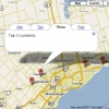
http://www.subkorea.com/api/google/MapsAPI/marker-textfiles.html텍스트(.txt) 파일 이용
<!DOCTYPE html PUBLIC "-//W3C//DTD XHTML 1.0 Strict//EN" "http://www.w3.org/TR/xhtml1/DTD/xhtml1-strict.dtd">
<html xmlns="http://www.w3.org/1999/xhtml">
<HEAD>
<META HTTP-EQUIV="Content-Type" CONTENT="text/html; charset=EUC-KR">
<TITLE>marker-tabbed 구글 (Google) 오픈 API</TITLE>
<script src="http://maps.google.com/maps?file=api&v=2.x&key=abc...xyz"></script>
</HEAD>
<BODY onunload="GUnload()">
<!-- you can use tables or divs for the overall layout -->
<table border=1>
<tr>
<td>
<div id="map" style="width: 700px; height: 500px"></div>
</td>
<td width = 150 valign="top" style="text-decoration: underline; color: #4444ff;">
<div id="side_bar"></div>
</td>
</tr>
</table>
<noscript><b>JavaScript must be enabled in order for you to use Google Maps.</b>
However, it seems JavaScript is either disabled or not supported by your browser.
To view Google Maps, enable JavaScript by changing your browser options, and then
try again.
</noscript>
<script type="text/javascript">
//<![CDATA[
if (GBrowserIsCompatible()) {
// this variable will collect the html which will eventually be placed in the side_bar
var side_bar_html = "";
// arrays to hold copies of the markers and html used by the side_bar
// because the function closure trick doesnt work there
var gmarkers = [];
var htmls = [];
var i = 0;
// A function to create the marker and set up the event window
function createMarker(point,name,html) {
var marker = new GMarker(point);
GEvent.addListener(marker, "click", function() {
marker.openInfoWindowHtml(html);
});
// save the info we need to use later for the side_bar
gmarkers[i] = marker;
htmls[i] = html;
// add a line to the side_bar html
side_bar_html += '<a href="javascript:myclick(' + i + ')">' + name + '</a><br>';
i++;
return marker;
}
// This function picks up the click and opens the corresponding info window
function myclick(i) {
gmarkers[i].openInfoWindowHtml(htmls[i]);
}
// create the map
var map = new GMap2(document.getElementById("map"));
map.addControl(new GLargeMapControl());
map.addControl(new GMapTypeControl());
map.setCenter(new GLatLng( 43.907787,-79.359741), 9);
var side_bar_html = "";
// === Define the function thats going to process the text file ===
process_it = function(doc) {
// === split the document into lines ===
lines = doc.split("\n");
for (var i=0; i<lines.length; i++) {
if (lines[i].length > 1) {
// === split each line into parts separated by "|" and use the contents ===
parts = lines[i].split("|");
var lat = parseFloat(parts[0]);
var lng = parseFloat(parts[1]);
var html = parts[2];
var label = parts[3];
var point = new GLatLng(lat,lng);
// create the marker
var marker = createMarker(point,label,html);
map.addOverlay(marker);
}
}
// put the assembled side_bar_html contents into the side_bar div
document.getElementById("side_bar").innerHTML = side_bar_html;
}
GDownloadUrl("marker-textfile.txt", process_it);
}
else {
alert("Sorry, the Google Maps API is not compatible with this browser");
}
// This Javascript is based on code provided by the
// Blackpool Community Church Javascript Team
// http://www.commchurch.freeserve.co.uk/
// http://econym.googlepages.com/index.htm
//]]>
</script>
</BODY>
</HTML>
http://subkorea.com/xe/84633
(*.225.54.140)
|
||||||||||||||||||||||||||||||||||||||||||||||||||||||||||||||||||||||||||||||||||||||||||||||||||||||||||||||||||||||||||||||||||||||||||||||||||||||||||||||||||||||||||||||||||